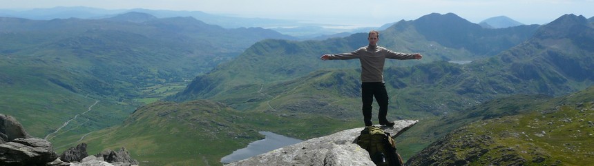
The trip, 2nd day:
Daily summary (Ordnance Survey):
Distance: 22.45 km
Total elevation: 1005.0 m

I knew for sure the weather was going to be awful today, but I wanted to test Pulcsi's new raincoat and of course I wanted to check out today's sights too, hence we stuck with the original plan this day as well. We got up relatively late around 7 am and after a bit of stretching we set off for our hike to make a call home.

The morning welcomed us with the appropriate amount of fog and strong wind for an unpleasant day.

We stretched well before starting the first uphill.

The car park's information makes it definitely obvious which national park you're staying at.

Common chaffinch.


Our every step was watched through the fog...

Having made the call we returned to the car to put on more suitable clothing and to pick up the gear.

For this time Pulcsi has been put away to keep her warm.

There you go, the the new fashionable rain suit. Contrary to what you might think it's not a bin liner. :)


Coming across drenched hikers makes one's heart swell... if you slept through the rain itself in you car.

Glyn Collwyn valley.

Having followed the Brecons Way for a couple of hundreds of metres we reached the entrance of Torpantau Tunnel. This side seemed to be pretty well flooded but my reading told me it should be relatively dry inside. We were to see it later on.

At the entrance we turned towards SE towards the top of the hills.

In the free to roam area amazing scenery surrounded us... at least all 15 metres we were able to see.


We got to the fist check point, the Ordnance Survey pillar marking 565 m altitude, 45 minutes after leaving the tunnel entrance. Here the wind was pretty serious, similar to the one I experienced on Cairn Gorm around 1000 metres. Of course there was a bit of a drizzle too so we decided to skip a picnic here.

In theory you can't perceive the wind looking at a picture, but I'd say this one disproves that.

And this one gives it a go too.

For the next 2 kms we crossed a featureless, often boggy highland, me wearing ski mask, goggles and rain suit.


Bog basin.

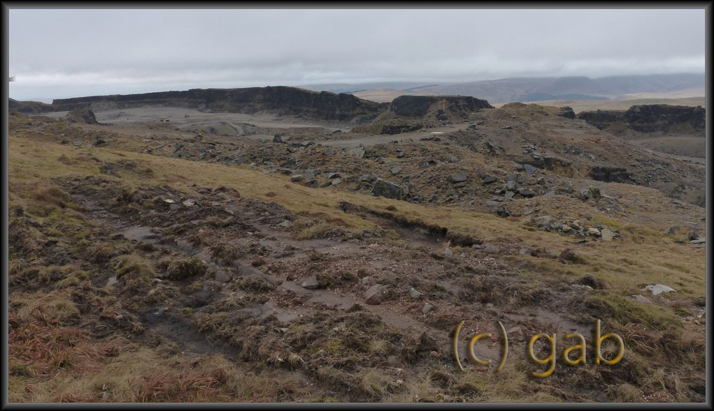
Finally Cwar yr Hendre quarry's spoil heaps appeared out of the fog, proving my navigation skills didn't fail.


We started to ascend to the quarry's level.

Then we went off to explore the deserted industrial site.

By this time the visibility started to improve too.

We came upon mining structures in the rock face after a short walk.


We examined these more in detail to start with.

Thanks to much better visibility we were able to see the terrain we crossed on the way here.

The small triangle shaped structure proved to be the entrance of a mining shaft that took you down to the level of the structures in the rock face.

Pulcsi is inspecting the shaft's entrance, building sized container structure in the background.

A bit further down looking towards the entrance.
The bottom of the slope was lit somehow, later we could see light came through a vertical shaft.

A tunnel straight on from the chamber at the bottom of the shaft opened into this tunnel through which you could get to the bottom of the rock face.

The chamber at the bottom of the shaft full of rubbish.


Huge container.

At the mouth of the 2nd shaft.


The northern part of the quarry.

Very artistic signs are supposed to deter anyone from entering the biggest pit.

Visibility improved so greatly even Glyn Collwyn valley could be seen behind the quarry.

We saw more and more shake holes, showing the karst nature of the area. 3 of them visible here.

The signs were getting more frightening.


The sheep seemed to have simply ignored them.

As a result Pulcsi looked at them furiously.

The northen edge of the quarry... to the right you find Mordor.

Pulcsi was imitating a rock, there's still space for improvement but not a bad start.

Water collected in the northernmost pit forming a lake with lovely turquoise colour.


Yes of course, the wind was still strong.

Frog eggs in an other random spot.

Someone lost their horseshoes.

Well-sized shake hole.
Once we mostly explored this quarry we headed towards the neighbouring Cwar yr Ystrad.

I picked this area for today's goal to check out the quarries and the 1.5 km long cave system opening from one of the pits. The entrance of the cave system called Ogof Tarddiad Rhymney is located in the wall of the pit opposite the rock tower in the middle of the picture. More info about the cave here.

This pit was huge, the longer side about a km and its area around 0.25 sqkm. Hence it took a while to reach the eastern edge.

The original plan to explore the quarry and descend to the cave entrance using the path failed due to the heavy rain, forecast for the afternoon arriving early. By the time I put on my waterproofs I was already drenched. Pulcsi was better off having worn her rain suit all this time.

We walked back to the shafts to find shelter for the time while I fixed Pulcsi's suit, so she could walk comfortably too.

Looking back towards the quarry on the way home.

The new design: the loose legs of the suit got taped around so she couldn't step on them any more while walking. It lasted all the way home, that was the next 4 hours in heavy rain.

It might have been this horse loosing the horseshoe.

After leaving the quarry I wanted the escape the open ground as quickly as possible so we descended towards the north to the paths across sporadic woodlands along Dyffryn Crawnon valley. At the first opportunity we crossed over to Glyn Collwyn valley around the Talybont reservoir. From here on we headed towards west.

The track became a brook in the rain.

Pulcsi switched into sleep mode at every stop now.

The destination was already visible: at the woodland's edge in the side of Craig y Fan Ddu hill the car awaited our arrival.

Rivers and waterfalls became wilder in the rain just as the waterfall on Caerfanell river in the picture, the one we passed yesterday.


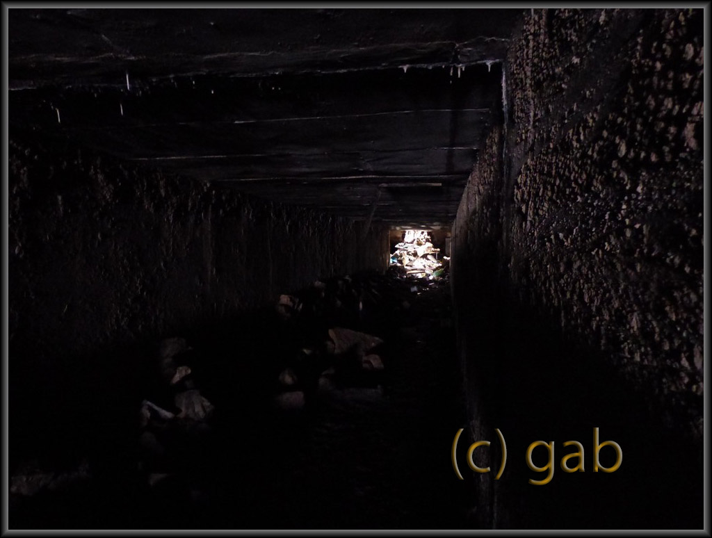
3 hours after leaving the quarries we got back to Torpantau Tunnel. If possible the entrance was even more flooded this time but trusting certain writings relatively dry environment awaits the brave/foolhearty inside. So, how do you cross here? You prepare: boots off, trousers pushed above knees, backpack on, boots in one hand Pulcsi in the other then it's time to put on the flip-flops.

After 10-15 metres the water ended and the gear better suiting the season was put on.

Then the walk began through the 609 m long tunnel, the highest one in the UK.

Here and there shelters were positioned.
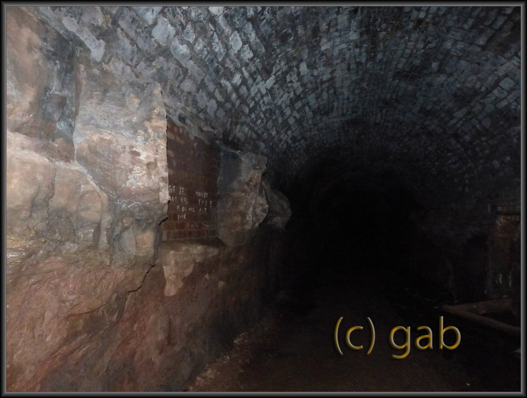
At many places the wall was made of bricks but quite a fair length was just bare rock.

And we reached the other side.

This entrance was carved through solid rock.

Halfway back my head torch's battery run out and this made the experience rather more exciting... of course I had a spare one.


The car was waiting for us faithfully.

The waterfalls beside the car park were in spate due to all the rain.


After 26 hours and 50 kms of walking with 3000 meters of elevation completed in 2 days sitting in the car and driving home was a real delight.